Wednesday 12 November 2014

Return to the Lake District (aka SDOTF) - Part 2

Sunday 9th November 2014 

Today's adventure started appreciably later than Saturday's, a veritable lie in with a daylight start. We were doing the Fairfield Horseshoe anticlockwise - Ambleside to Rydal, taking in 8 Wainwrights along the way.  Anticlockwise avoids doing a nasty neverending ascent up the hobbit steps of Nab Scar.  We saved that joy for last.  Worked out well though, I didn't give much of a fuck about anything by the time we got there! 

When Nici first mentioned this route to me I had a quick Google.  Jaysus, some ascent and then a long long time up on the ridge, with a long long way to fall down (not that I was planning to do that). I'm not the best with heights, I'll get dizzy if I let go of the handrail going up on the Tube escalator, so I decided to watch some Youtube videos to prepare* myself. 

*hafuckingha

Most of these Youtube videos were done clockwise and on lovely sunny days. It sounded like a good hearty hike with a bit of vertigo thrown in for fun. Bring it on! 

Official blurb: 

The horseshoe walk is a 16 kilometre journey with 1100 metres of ascent and includes the peaks of:

Low Pike (508 metres)
High Pike (656 metres)
Dove Crag (792 metres)
Hart Crag (822 metres)
Fairfield (873 metres)
Great Rigg (766 metres)
Heron Pike (612 metres)
Nab Scar (440 metres)

 
I can't get the elevation bit to save as a separate pic, Windows 8 is a twonk 

James had sent Nici a very handy link for the local weather, which warned us that temperatures would be below freezing above 700m.  Seeing as that would be the greater part of our journey we were very glad of that warning and packed accordingly. 

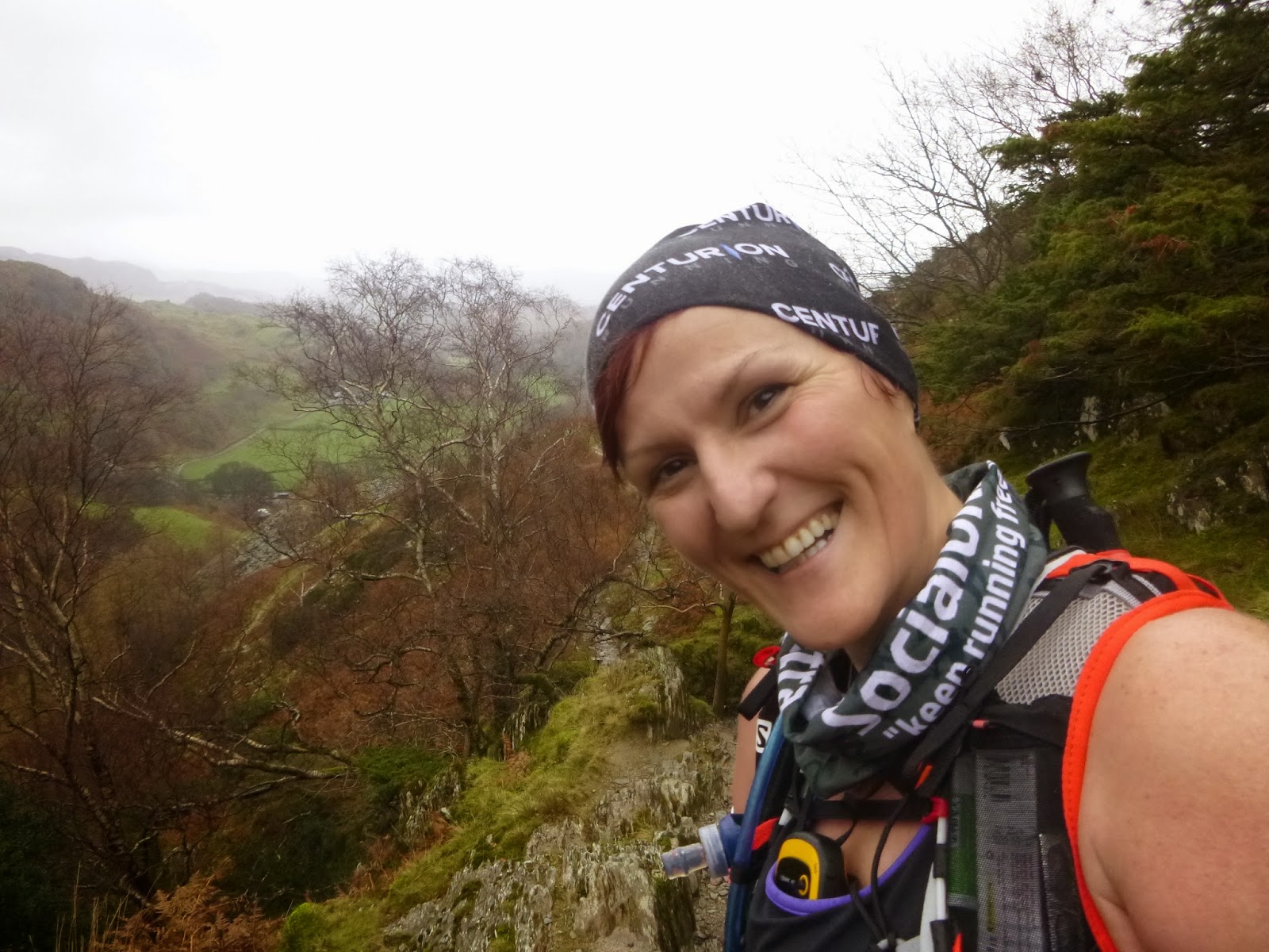
By the time we got to the edge of Ambleside the rain was getting heavy so we decided to stop there and then and get the waterproofs on.  From that point I was wearing an Icebreaker longsleeved base layer, a technical tee and Montane Minimus, with full length tights and shorts.  I don't think I've ever worn that much to run in apart from in the snow.  I was very glad of it though. 


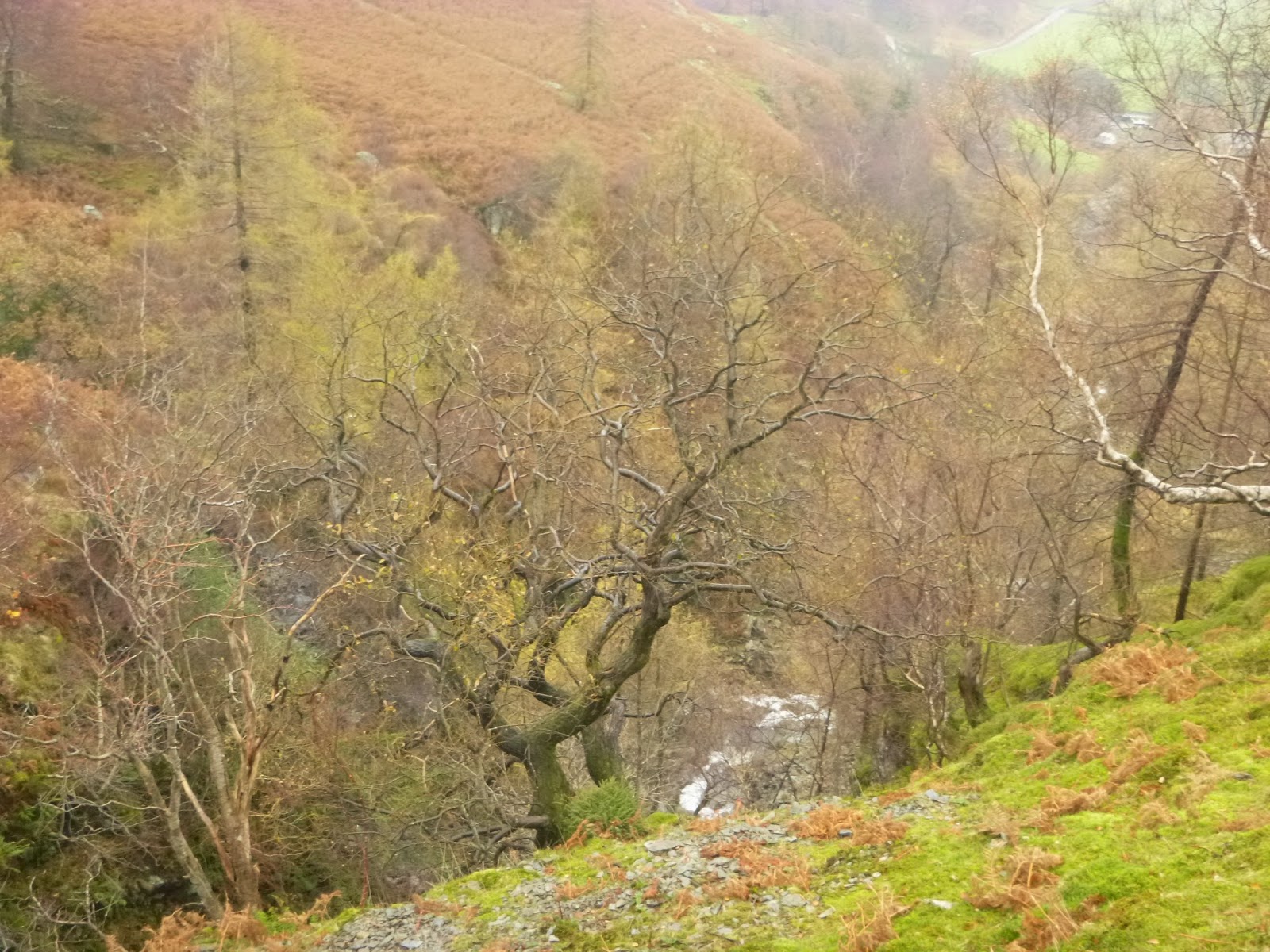
A nice brisk walk up to Low Sweden Bridge and then we started the ascent through fields. It was pretty, looking back and seeing Ambleside below, but my God it starts off climbing and doesn't let up. Eventually we came to the wall that we would be keeping to for most of the way to Hart Crag. It was pretty cold already but great to be on the way. The ground soon became boggy and progress slowed as we tried not to get stuck in it. 


Somewhere between Low Brock Crags and High Brock Crags (wet craggy bastards) is a thing called the Bad Step.  We took a couple of close up looks at it, said "fuck that" and diverted down into a field for a bit before climbing back up to meet the wall. 


Along here we ran into the Bog of Doom *SDOTF.  It must've taken a good 15 or 20 minutes to get across that bastard. It was funny and surreal but at the same time we couldn't afford to lose a shoe to it or that was the day ruined so we had to be careful.  The tip of my feckin pole got stuck in the middle of it and came off, I could see it gradually sinking and tried to get it back out, splashing some bogmud up at Nici in the process, but I soon had to admit defeat as the bog wouldn't relinquish it's grip and so I left it there to eventually work it's way down through to China. 


Low Pike was a bit of "are we there yet?" as there is no cairn, the wall goes directly over the peak, which involved a fair bit of scrabbling over wet rocks.  And we couldn't see much anyway so if the non existent cairn had been over to the side it could do one. 


Looking up to High Pike from Low Pike - picture lifted from Wikipedia as it was too wet and claggy
to actually see it in real life  

The clag was coming in heavily now and we really couldn't see very far around us at all, probably a good thing.  Just continuous walls of rock looming ahead of us in the mist.  The terrain was mostly bog and wet rock.  Our gloves soon got wet from scrambling up rock slabs with streams running down them  *lesson learned - I need better gloves for this kind of thing, my hands really got bloody cold, and early on too (I had meant to wear 2 pairs but forgot a pair).  At points there'd be a steep rockface ahead and you wouldn't be able to see if there was a way around without going right up to the edge of it. Nici very kindly checked these bits out, knowing I was struggling a bit with the heights thing. 

Might be High Pike but I'm not sure to be honest!  It was all a claggy blur

At some point along here the various directions or whatever we'd read had recommended climbing over the wall from east to left side as the terrain was easier. That may have been at the Brock Crags, I can't really remember. What I DO remember is trying to climb over a wet chin-height wall with pissing rain, wind, stones moving on the top of it and fucking hell that was a mission!  Of course there wasn't a convenient stepping stone down off it, only eejits use walls like that for climbing over, but after a lot of faffing and squealing and laughter we got over the bugger. 


We were steadily gaining height now, yet still coming across cow pats.  Bloody weirdos, what the hell are they doing up there? There's more bog and stone than grass, and none of it on the level. Copious amounts of shit at that, they really need to stop eating hikers.

Somewhere along this ascent I put a Buff around my face, one over my head, put my cap back on, pulled my hood up, and put on an extra gilet.  Thank Christ I did. 


Let's take it that we're on the approach to Dove Crag now ok, I can remember screeching at Nici at one point (when very wet and tired from all the rock scrambling) "why aren't there any fucking signposts or nameplates on these things?".   I think there not being a cairn on Low Pike threw me a little, I hadn't realised until writing this blog that it doesn't have one.  Think you're well prepared for something, then go back and do some more prep!!  More feckin lessons learned.  

The Inov-8 212s totally earned their place in my heart today though.  My God those shoes are great.  Steep grassy banks, streams running down over rock, bogskating - they handled it all and gave me a lot more much needed confidence in those conditions (I'm not moaning about the conditions btw, what else would you expect on the fells in November, but fucking hell it was tougher than anything I've ever been out for that long in). 

Suddenly out of nowhere the clag lifted and we got a few minutes of Heaven :-)  I think we both danced a bit for joy, then I grabbed my camera to record the moment. Sight of the western side of the Horseshoe was amazing, I'm so glad that we did get a few minutes here and there where we could see the views.  Next time I'll do this one in the summer. But it was good to get it done in such shitty conditions and rise to the challenge. 


It was a very ultra-like day in that the language and topics of conversation were most definitely not what you'd want your elderly aunt to hear. I was having a loud rant about my knickers going up my arse and various other unmentionables when something made me look around and there were two bloody men running up behind me.  I think the wind blew my words away from them though, they didn't look too shocked.  

Onwards and upwards to Dove Crag.  No feckin birds out in this weather, they've more sense.  Oh, I've just looked at the fell race map and it says to cross the wall here for better going.  Maybe that's where we had our climbing wall episode, not where I put it above.  Ah well.  We climbed a big wall. Somewhere. 

Met some nice bloke up here, he seemed to want to stop and chat but we were just too bloody cold and wet to hang about. Shame. Ah well, I'm sure he survived without our scintillating convo. 

At Dove Crag was a kind of turning point, onto the top U of the horseshoe, it was a nice point to finally reach. Nici had the route on her GPS thingy and it was a Godsend. I had it on my 310 but because we had to 'divert' around bog etc he kept bleeping and telling me I was 'off course' which really fucked me off after a while so I switched him back to normal view.  We both had good maps and I'd a compass I was prepared to use, but with such cold hands it would've been a mission.  Again, lesson learned, dress for the cold and wet and then dress some more. 

I have no pictures or videos for the next couple of miles. The clag was down to about 2-3 feet visibility, there were serious drops to either side (which we couldn't see), and my hands were too fucking cold to hold anything but my stick. I don't think I've ever concentrated so hard on anything in my life.  We were already knackered from the ascent and battling over the water/rocks, now we were onto a section that was so disorientating in the clag that it was actually quite scary.  

Obviously we weren't running on this part, following the GPS was the main priority.  At one point I started shivering uncontrollably, my core had been toasty up till then, and I must admit it worried me a bit.  We dressed adequately, the only error made was the gloves, but on a bad day that would be error enough.  I think this must've been around Link Hause.  We heard voices but couldn't see where the hell they were coming from. Of course if we'd really been stuck then we'd have shouted but taking it slowly and carefully kept us on track for Fairfield. 

Then the clag lifted and we saw around us.  I think I saw Helvellyn, I saw something bloody amazing anyway, but without my compass out I didn't know what direction it was for sure so I'll take it as that one.  

We also saw Fairfield up ahead, with happy people on the top, so I said to Nici "come on let's run for it while we can see the fucking thing!".  So we did.  Till the clag drew back in. 

Let's throw in a picture of the Horseshoe now so you can see what we had been hoping to see!  And what we did go around :-) 


Got to the summit in one piece anyhow, there was a group of people having sandwiches in the shelter so we walked over to some crumbled wall or something and had a brief shelter from the wind while having some food and sorting the direction down off it. 


Then the clag descended again and all signs of life vanished.  We reckon we were the only ones up there that day, the rest were ghosts. Sinners doomed to forever roam the Fairfield Horseshoe. Like Albert and Marigold on the 505 *SDOTF

At one point I said to Nici "that's the edge there and you know what? I don't give a fuck anymore! fuck the fucking edge!"  I tend to get a bit cranky when I'm scared :-) 

From this point we got in some lovely running.  The feet were soggy anyway, I'd foam coming up through the 212s for the last couple of hours, so there was no point avoiding the streams anymore.  Nici indulged in some mud running and sliding, very funny to watch. 

The peaks over this side were easier to get up as well, still steep but there was no shitey rockslab scrambling as there had been on the eastern side.  So glad we did that bit first though, that would've been quite gruelling on tired legs. 

Great Rigg was the next peak after Fairfield, don't remember much of that tbh, claggy hill, hilly clag, nuff said.  

The Herdwicks made an appearance up here and what a lovely welcoming sight they were.  I reckon that any place where Herdwicks are has to be pretty cool. 


And so we carried on - running, slipping, sliding, hiking, laughing - to Heron Pike.


I think that's Heron Pike, or thereabouts, comes in the right sequence of my photos anyway

The temperature was noticeably 'warmer' here, thank God, and as we were descending we finally caught sight of Rydal Water and on the other side some of the valley of the Horseshoe itself. Fabulous. 


Down, down, down and onto the steps of Nab Scar. Jesus wept. Zig zag down down down.  You'd get to the curve and think that surely must be it, but no, more legs of these slidey hobbit steps.  Beautiful place, but fuckin hell we were tired by then, it needed to end!   


And then it did :-)   Past William Wordsworth's gaff, down a manky ribbed concrete lane, ouch, and then 17 miles back into Ambleside (not really, felt like it though). 

And so the end of the adventure.  Would I do it again? Hell yeah!  Am I going to invest in serious winter gloves?  Fuck yeah!  

I don't think there's anything we need to do differently, apart from better gloves.  We got the fuelling right, kept moving, realised when we were possibly heading for a little trouble with regards to shivering and dealt with it, double and treble checked directions when in low visibility, all in all a very valuable fell experience.  On the hairy parts, and especially when sprawled hands and knees clawing my way up rockfaces, I really just wanted it to be fucking over, but I guess the fear of heights is still there to be tackled and with time and more exposure I'll get there.  The trekking pole was an absolute essential and it would've been so much harder without it, even sans tip!

The date for the next Lake District visit hasn't been set as yet, but when it is I'll be counting the days. It's so hard to leave though that one day I just shan't*

*not in a SDOTF way though 


Monday 10 November 2014

Return to the Lake District (aka She Died On The Fells) - Part 1

Having been to the Lake District in September to recce part of the Lakeland 50 route with Nici, when she asked if I'd like to go back in November I said "Ah Jesus, really? Must I?"   HAHA fuck no, I counted the weeks and then the days and then the hours!

We stayed at the Ambleside YHA this time. A train up to Oxenholme, train to Windermere, then a taxi to the hostel. First impressions - arriving there on a Friday evening - was that it wasn't as friendly or runner/hiker orientated as the Coppermines one, the bar seemed to attract a lot of people just out for a drink rather than there for outdoorsy type stuff, but it was warm, clean, just a mile and a bit from the town and so it worked well.  More runners and hikers arrived on the Saturday so it felt more like our kind of place.


After checking in to our palatial bunkroom we ran into Ambleside to stock up on some food for the weekend.  Had dinner in the bar, got our stuff ready for the morning, set the alarm for 04.45 and went to bed.

On the Saturday we were doing another recce of the Ambleside to Coniston legs of the LL50. Here's my description of that:-


Ambleside to Chapel Stile (CP12-13)

We had about a 1.5mile run to the start of the actual route going down into Rothay Park. That was far more pleasant done via headtorch than last time in daylight with lots of people around. After a slog up a bridleway and a few gates with various differing methods of opening same (which is great stuff when tired and brainfogged during a race) we were out onto the fell.  Awesome downhill running along here, we woke every bog creature around with our yells of joy.  Sunrise didn't really happen as such, it was very clouded over so eventually we just got to a point where the headtorches weren't needed anymore and put back in our vests.


Onward we went, past the Skelwith Bridge Hotel, Chesters, Elterwater and onto the path opposite the cave entrance.  We had planned to restock on water at Wainwright's Inn as we'd run out before Tilberthwaite the last time and had a bit of an ordeal getting some from a mardy farmer woman. But we got to this point far faster than on the last recce and so the pub wasn't open.  Their 'outside tap' for dogs was cleverly piped down into a bowl thing and neither of us much felt like filling up from that so we carried on.  We were both carrying an extra 500ml anyway and it was far colder and wetter so we weren't too concerned.  The Baysbrown campsite hadn't even a tent in it letalone a tap so meh to that too.

"Straight on footpath thru houses (QUIET PLEASE) and down walled path, through gate".

^^ a direction that will never be forgotten thanks to some twonks in September :p

Along here we once again resisted the lure of the Most Dangerous Swing in Britain.  Here the legend of the tale of She Died On The Fells was born.  Nici fell off the swing and had her eyeball pecked out by a crow.  Just one of several near fatal mishaps on our journey.

We took note of where CP13 would be located in a field on the right at Great Langdale Beck, and then I saw some of my favourite creatures....


Loads of them actually. I'd been quite disappointed not to see any from the train the day before, it doesn't feel properly like Cumbria till I've seen a Herdie, so I did literally jump for joy on entering this part of the course.  They have such friendly faces and they stop what they're doing to look at you - it feels rude not to greet them.  After encountering about 7 or 8 of them and waving at each I said to Nici "ooh I feel like the queen!".  Nice work if you can get it eh.


Chapel Stile to Tilberthwaite 

"Continue on track and bear L to Oak Howe Farm (QUIET PLEASE). Turn R on public footpath after main barn (SP New Dungeon Gill). Continue on clear track for 1.2km to gate in wall........"

Hah!! Doesn't mention the feckin rabid bullocks we encountered in September though does it.  I was very relieved to see an empty field this time, though we did still run faster through that part.

On through boggy fields, over streams (lots of extra water up there this weekend) and over two mothers of stiles (I'd call them ladders myself).  And at that stage of a 50 mile race they're fair sadistic.

Italian Hill was next.  This was a killer in the heat before, and pretty tough going this time too, but we got up faster and knowing just how long it was made it a bit easier. Over a cattle grid at the summit of Side Pike Pass and then some smashing downhill trail to Blea Tarn. The terrain around here is lovely - downhill stony/rocky trail, narrow paths alongside a drop down to a stream, nice ankle turning territory, loads of bracken, slopes on the right, mini waterfalls, truly a great place for running.

"Very boggy ground of Bleamoss" - the poles were taken out for the first time here, and we were quite glad to have them, the ground was saturated and the bog was hungry for shoes. *She Died On The Fells. We got through ok though, did the check on the wooden gate, then had some downhill road running for a bit.  This bloody hurt but my new 212s did better than my other shoes would've done.

Soon we were on the track to the white NT cottage. This place is a crock of shit.  There's no water tap so why exactly is it even worth a mention?  Somebody died around here, I won't post the pic, it's too emotional :p but that NT b.s. needs to be removed.  Her little legs carried her far but she still DOTF :p

Uphill a bit on track, then some stony slippy downhill to Mardy Farmer Woman's place. We cocked a snoop at Her Mardiness and ran on.


Then followed a bit of country lane running to Tilberthwaite car park where CP14 will be located. The steps up out of this didn't seem half as long or as bad as we'd remembered but that made no odds to me, I knew what was coming.

Tilberthwaite to Coniston

"At triple fork, 300m from CP, take middle track uphill (SSW). DO NOT enter quarry on LH track, DO NOT take lower path down to Crook Beck. Continue up for 200m (CARE - steep unfenced quarry side to L of track) to cross small waterfall/stream bed. Continue 500m, up rocky section"  - aka the Wall of Death

We had taken lots of photos here before, looking around the quarries etc, and had decided to plough on through this time. Still all very scenic and such but as it was the lead up to the WoD my guts were already trembling.  The small waterfall was raging after all the rainfall lately, I was so shitted up nervous that I put my foot straight into it rather than stretch enough to reach a dry rock. Made no odds, my feet were soggy by then anyway, but it didn't help the nerves.  I must admit the WoD wasn't quite as horrendous second time around as I knew IT WOULD END and I wouldn't die.  Unless I slipped off the right edge into the ravine. But I got up it anyway and was able to speak afterwards, unlike the last time and Nici gave me lots of praise even though we'd misconstrued which bit exactly was the WoD :-)

Having lived through the hell of WoD and the 2 inch wide path after that, still running along beside the ravine, we started to have fun again. Clag was descending but it felt great.


The section up here (between Low Weather Crag and Yewdale Fells) is one of my favourites.  No sign of humans, animals, buildings, electricity lines, nothing - just pure open fell.  Perfection.  The stream by the tree was too deep and fast to cross so we cut across through some boggy reedy stuff, found a narrower bit and got across that way.


We stopped briefly at Scab Rock for some food (did very well on this recce, hourly refuelling and it made a hell of a difference to the last time) and to see if my sacrifice was still there. Nothing but some crow skeletons. Silly birds. *SDOTF


"with valley of Crook Beck again on R. Past small tarn on R to summit. Over summit and continue steeply down L (SSE) on rough path to reach main track"


It's funny how often it is true that words can paint a picture and yet with the Lake District they just can't paint enough. You have to be there. The atmosphere, the feeling of clean air, the rain, the space, the joy, the pain, the tiredness, the joy.  The joy.


Eurgh. I'm getting silly.  Carry on.

Ok, So we carry on over the summit and then see one of my favourite places ever, Coniston Coppermines Valley. I won't go off into one about the beauty of this place again.  Just visit it. Down down down a steep rocky track, taking in the sights and enjoying being back there again. Couldn't see Old Man Coniston, he was all clagged up :-) 

Down a steep concrete track/road, OUCH, into Coniston village and the end.  I messed up on bus times and so we found ourselves with an hour or more to spare. Had to go to the pub, godammit :-) Then we caught a bus back to Ambleside, chilled a bit and got ready for the next day's adventure.

Awesome second recce. Felt faster and stronger, we fuelled better and had more fun. Happy with that one.

(I've saved the swearing for Return to the Lake District (aka SDOTF) Part 2) 


Sunday 17 August 2014

Finding 'Happy' on the Chilterns


Having run from Overton Hill to Goring at Easter I'd always intended to go back and finish off The Ridgeway at some point, though in my mind it had now moved to a weekend next year, when I'm fitter. On Wednesday this week I thought "bugger it, I need a break from the madness, I'm doing it" so I booked a room in Wendover for Saturday night and train tickets. Didn't really have time for prep, just a quick look at distances and a rough plan. 

Come Saturday morning my alarm clock got laughed at when it started it's racket at 6am. It got laughed at for a few hours, with the result that I set off to Goring much later than planned.  By the time I got off the train in G&S I realised that I might have to play it by ear with regards to where I stopped running for the night.  

Running along beside the river was pleasant enough - rivers and flat don't really rock my boat though. Then I came to a field full of cows. Right across where I had to run. Jesus wept. A man had already gone through with his dog so I was thinking 'shit they're going to be alert now'.  But there was nowhere else to go, the river was on my left and more fields of cows to the right.  So I walked through them, heart in my mouth.  Two of the bastards were over on the left right beside the river so I couldn't keep on that edge, I had to go between them.  I've never been so happy to reach a gate.  Where I stopped to take a photo and start breathing again.  


I'd had a good look at the map on the way up (and actually measured distances!) so I knew when I should be hitting South Stoke, North Stoke, turning east etc.
  
Grim's Ditch was a bit disappointing to start with, the name conjures up images that reality just didn't deliver.  Again, pleasant but not earthshattering. 

This is more like it! 
After a while it turned into the kind of terrain I was hoping for ^^^

It was surprisingly humid so I was glad to fill up my bottles at Grimsdyke Cottage, a litre gone in just 8 or so miles. I'd met a couple of dog walkers along the way but other than that it was quite deserted. 

Nuffield Golf Course was a mare!!!  I ran in, saw a sign for the Ridgeway pointing left across what looked like a practice green, so off I went. Got to the edge of that and really could not see a way through the brambles etc. Shit. So I went back to the club house.  The map seemed to indicate to take a tight left and I'd seen a couple of hikers stopping there, consulting their map and going down the path, so I went that way.

Came out on a road. Ok, now cross and look for the Ridgeway sign.  Hmmm. The two hikers were up the road a bit so I ran up to them and asked if they were going the same way.  They were.  A lovely young Dutch couple who were hiking to Watlington.  The guy asked if I had ALL my stuff for 2 days in the S-lab??!!  He had to take it to feel the weight lol.  We had a nice chat while wandering around the poxy golf course trying to find the right path. Anyway, the least said about Nuffield the better. Never trust a golfer who gives you directions, suffice it to say that much. We eventually found the way and I left them to it as I needed to get a move on.

A few nice ups and downs through crop fields ensued.  A little bit of road, some mini hills and onto Swan's Way. Pfft. Running on a trail between two ditches of bushes/trees that were so thick you couldn't see any scenery. It was pretty uninspiring.  And straggly.  Not pretty at all. I met a lady walker and I thought well I'm not going to get to Wendover before darkness falls and I sure as f*** don't want to be running through this on my own in the dark (it didn't feel very friendly) so I'll find out from her where's the best place to stop.

Jaysus. "I walked from Ivinghoe Beacon to Watlington once. It was soul destroying".  After a minute I was trying to end the conversation and politely leave!  I asked her about Chinnor, would I be able to get a cab to Wendover from there?  "The path is awful, it's horrible, there's nothing there".  Omg. Managed to get away and upped the speed!  I was very low on water by now so I decided to drop down into Watlington and get to the hotel for an early dinner and night.  On the way I asked a man if I'd be able to get a cab in Watlington. "Ohhhh, no, there's nothing there. You might get a bus. But it's a Saturday. So probably not".  He had hairs growing from the top of his nose. He wasn't old enough to have an excuse for that!  I was expecting his next line to be "we only have local shops for local people".  Fuck me they're a miserable bunch around there!

So I went back up onto the Ridgeway and decided to head for Chinnor come what may. 

Taken at one of the rare open spots along here


Looking at the map I noticed that Lewknor had a PUB symbol, woohey, civilisation.  Decision made, drop down into Lewknor and take it from there.  The landlady called a cab for me and I had a pint of cider while I waited. 20.5 miles run, longest run since June, can't complain about that!

Got to Wendover, had a pint, had a shower, had some dinner, another pint and up to bed. I was in two minds about what to do next - get a cab back to Lewknor in the morning and carry on from there, or start on Sunday from Wendover.  Working out the price per mile that going back to Lewknor would cost me made the decision fairly easy!  It had been a nice day of running and fresh air but missing out on running through a quarry and Chequers (where I'd probably get arrested for peeing in his garden) wasn't going to upset me much in the long run.

Had a nice sleep and then woke up around 8 on Sunday morning.  A full cooked vegetarian minus the sausage, boom, set me up nicely for the day.  The receptionist told me a shortcut to get onto the Ridgeway rather than strictly following the map. Jaysus. Put me in the middle of houses and alleyways and shite like that and I'm buggered, I had the compass out twice just to get out of town!  But I was going the right way after all and soon was out in the countryside again. 


I met a lovely blonde lady runner along here, in her 60s, fab pink top, cheery hellos - how else would you want to start a run on a Sunday morning :-) 

Today (Sunday) was definitely my favourite of the two. Where Saturday disappointed Sunday more than made up for it. The woods on Cock's Hill were gorgeous.  And Uphill was like running through light green gossamer threads.  Beautiful. Calming. Relaxing. 

Met a few mountain bikers speeding down this bit, it did look like good fun. I was going uphill though. It felt like being in the Lord of the Rings. Loved this part. I think the magic started to happen from here. 


Had to do a bit of road running through Hastoe but it was raining so that made it ok :-)  And Tring Park, what a lovely place.  Met lots of walkers here, and all friendly.  

A bit more running down the sides of fields now on the way to Tring station, nothing special but it was downhill so I got through quickly. 


Ran over this bridge then realised what it was so went back to take a photo. It's the only way I'll be running anywhere near it!  

Grand Union Canal 

Past Tring station and up onto one of the best sections of the entire run. More lovely uphill forests and a nature reserve. I'd seen lots of butterflies and a few rabbits but very little other wildlife until here.  


Then 3 deer ran across my path, so quickly and ethereally I gasped aloud.  God it was beautiful up there. Running through those woods I really started to feel the history of the Ridgeway again. I'd felt it before in Uffington, awe inspiring stuff, and now I felt how the Roman Centurions might have felt all those centuries ago marching from place to place. Didn't think it could get much better than this. 

Until I came out onto Pitstone Hill. You know when somewhere just takes your breath away? This was that place. Looking at my photos now they just don't, they can't, convey what it was like, you have to be there. It was so amazing. 


I was blown away by now, I'd had my camera in my hand for the last few miles as there was no point putting it back in my pack only to have to stop and take it out again. And then into the final couple of miles, I really didn't want it to end, but at least I was going to be running back this way to get to Tring station and there were some fab downhills through the woods to look forward to. 

Going towards Incombe Hole there were more feckin cows in a field to pass, but these guys were all lying down and looked pretty chilled. I let a walker run the gauntlet first!


Up Steps Hill, through some narrow trails surrounded by gorse and wildflowers and scrub. Perfect.


And finally, destination reached. I won't lie, it was emotional. I don't even care that I can't say I've run every inch of the Ridgeway, I've run 88 miles on or around it, and definitely got to see the best parts. Yesterday was nice, not a stretch I'd bother doing again in itself, but it got me to today and today has been fantastic. And when I'm feeling stressed or can't get out for a decent run I'll just look back on this and feel it all again